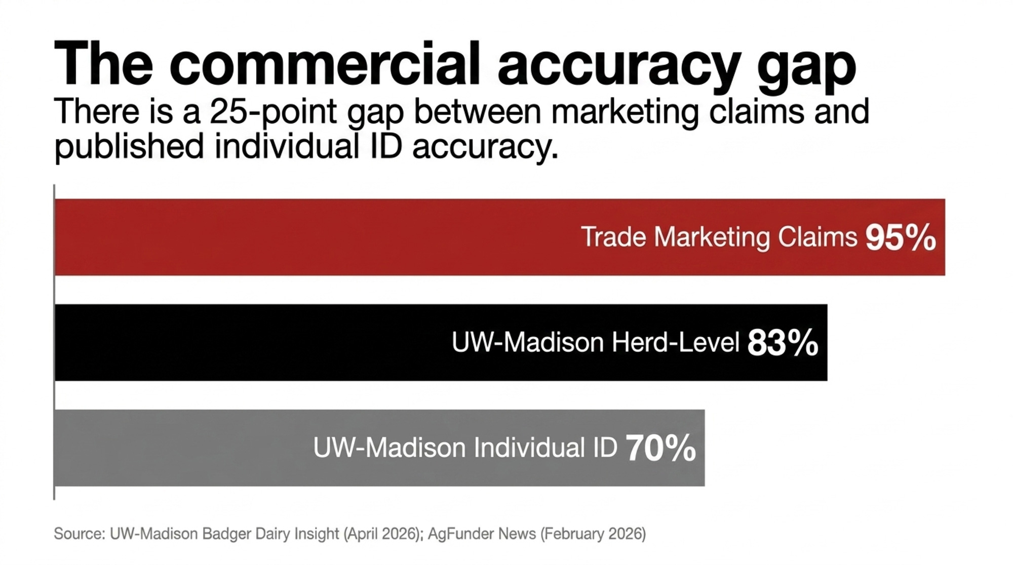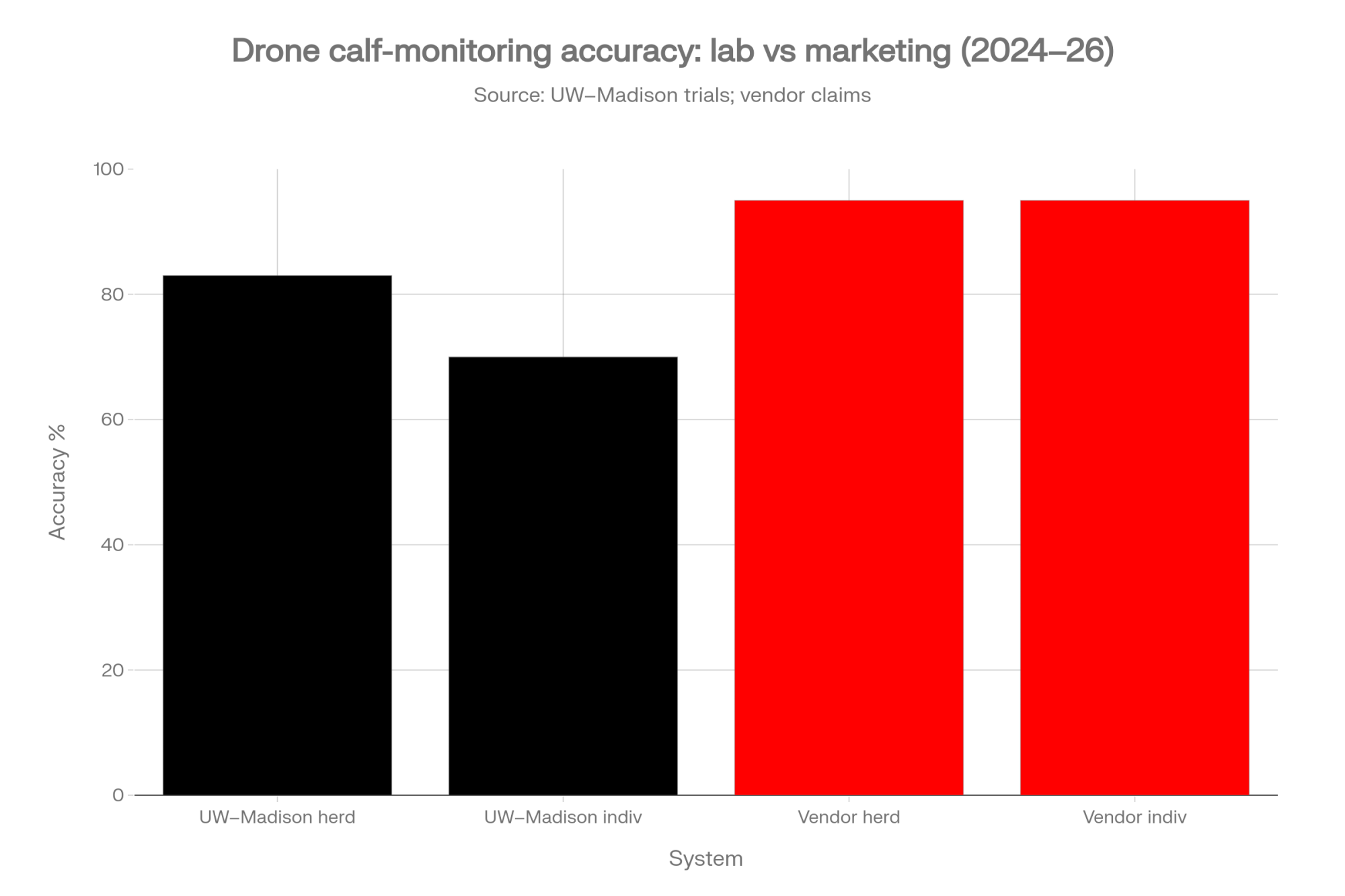






Three in ten IDs point at the wrong calf. Across a 200-calf hutch row, that’s about 60 records tied to the wrong hutch, and the headline accuracy number won’t show it.
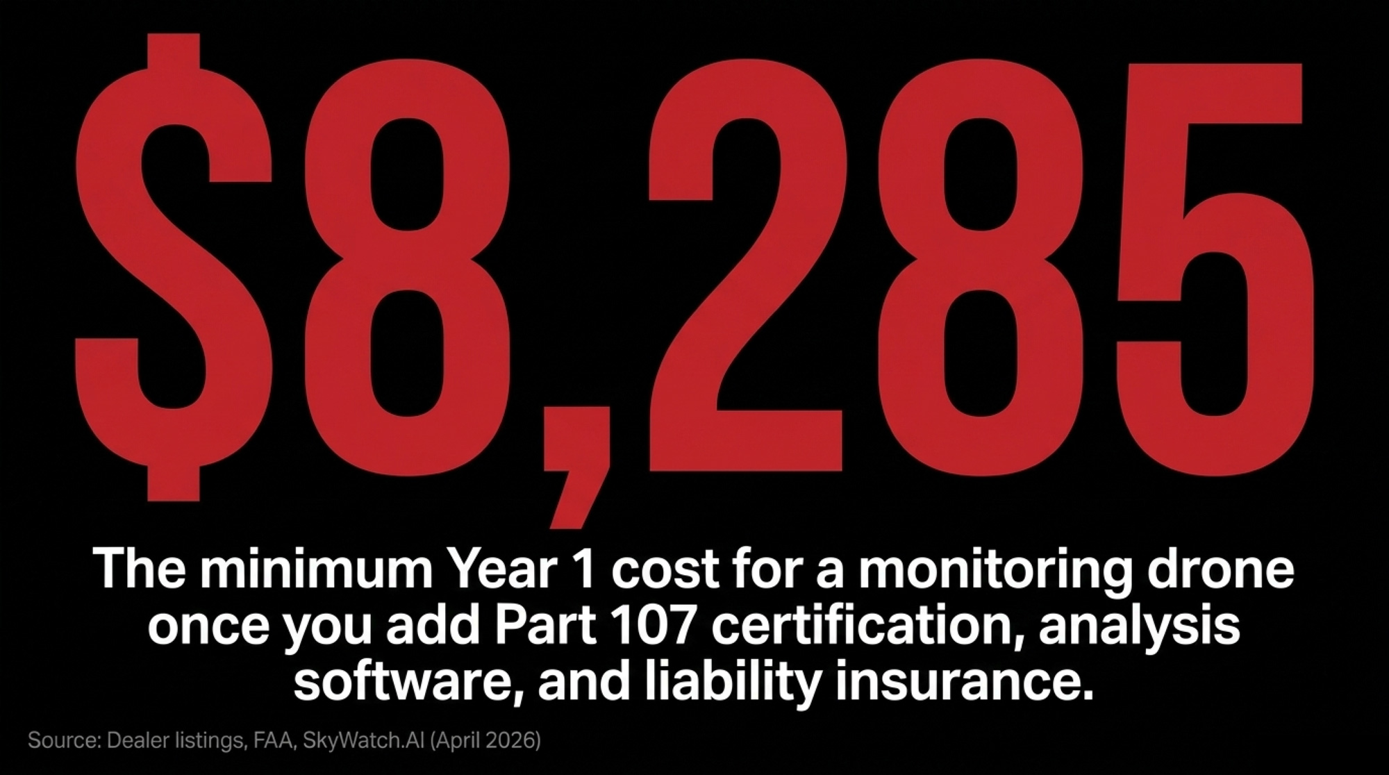
Executive Summary: UW–Madison’s calf-hutch drone, presented April 27, 2026, sorted roughly 800 calves as in or out of their hutches with 83 percent accuracy but identified which calf only about 70 percent of the time; the study didn’t test whether it catches a sick one. For dairies in Wisconsin, the upper Midwest and Ontario weighing a buy, Bullvine priced year one for a Mavic 3M at about US$7,670–9,010 or CA$5,965–6,950 and ran spray payback at 500, 1,000 and 2,000 acres against University of Missouri Extension’s 980-acre breakeven. Canada’s SPN2026-02 opened drone spraying of aerially labeled products on June 30, with provincial licensing intact. Bullvine’s call: scouting drones pay first; calf-health alerts wait.
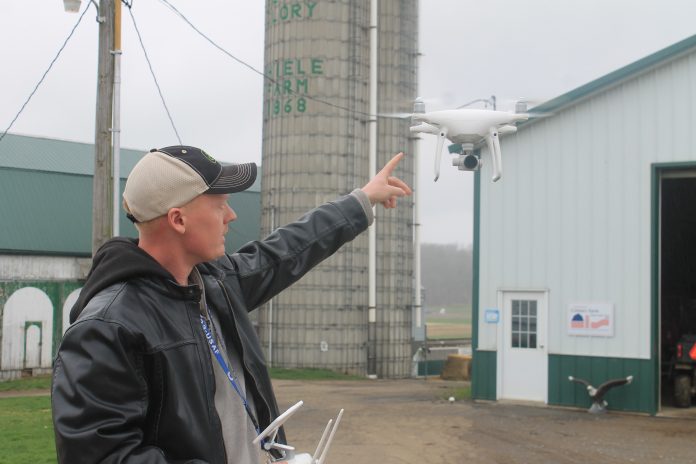
Hail had hit Wisconsin the week before Dr. Neslihan Akdeniz’s April 27 Badger Dairy Insight talk, and that morning she’d watched a neighbor fly a drone over his roof to check the damage. That’s about where most producers’ picture of this technology still sits. The sales pitch is counting on it staying there.
Akdeniz ran the emissions half of UW–Madison’s drone project, and she named its limits herself, on the record.
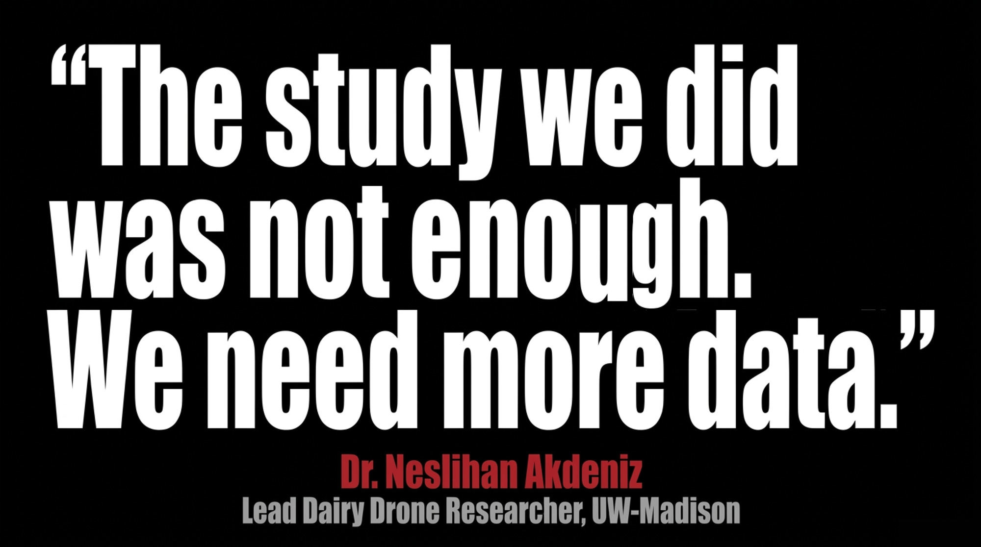
“The study we did was not enough, so we had only two dairy pastures, 2 beef pastures and only one sheep pasture… We need more data.”
— Dr. Neslihan Akdeniz, UW–Madison, Badger Dairy Insight webinar, April 27, 2026
Can a Drone Flag a Sick Calf? What UW–Madison’s 70% Means
Gustavo Mazon presented the calf work. He’s a former postdoctoral research associate in UW–Madison’s Department of Animal and Dairy Sciences, now a Technical Services Nutritionist at Axiota Animal Health. His team flew at 60 feet over a commercial facility housing roughly 800 calves in individual hutches. They captured an image every five minutes from 7:30 a.m. to 4:30 p.m. for six days straight.
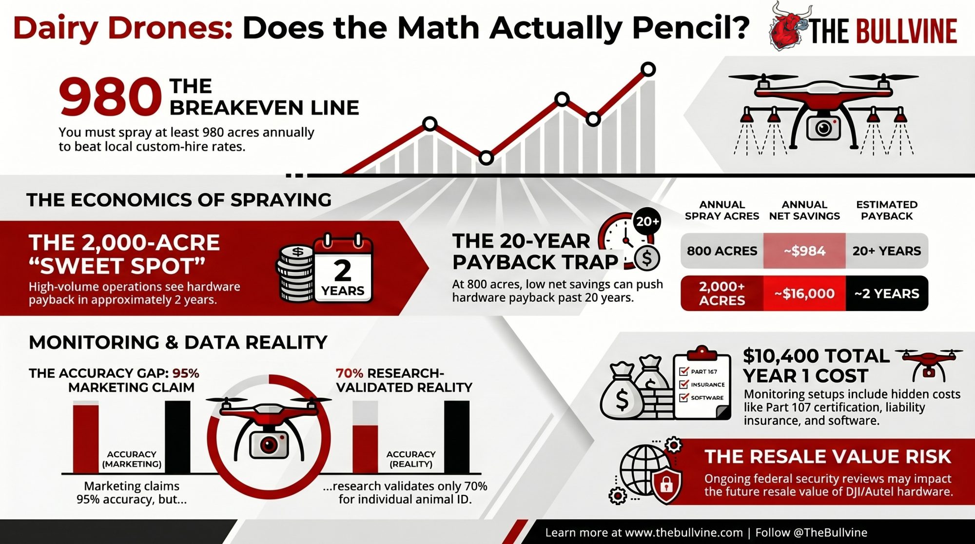
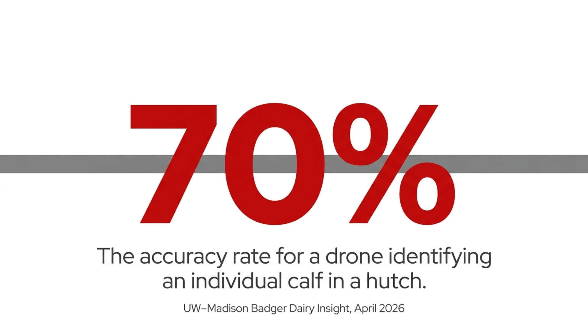
Herd-level classification came in at 83 percent. Individual identification came in around 70 percent. That’s how often it knew which calf it was looking at, and Mazon described that part of the work as still in progress.
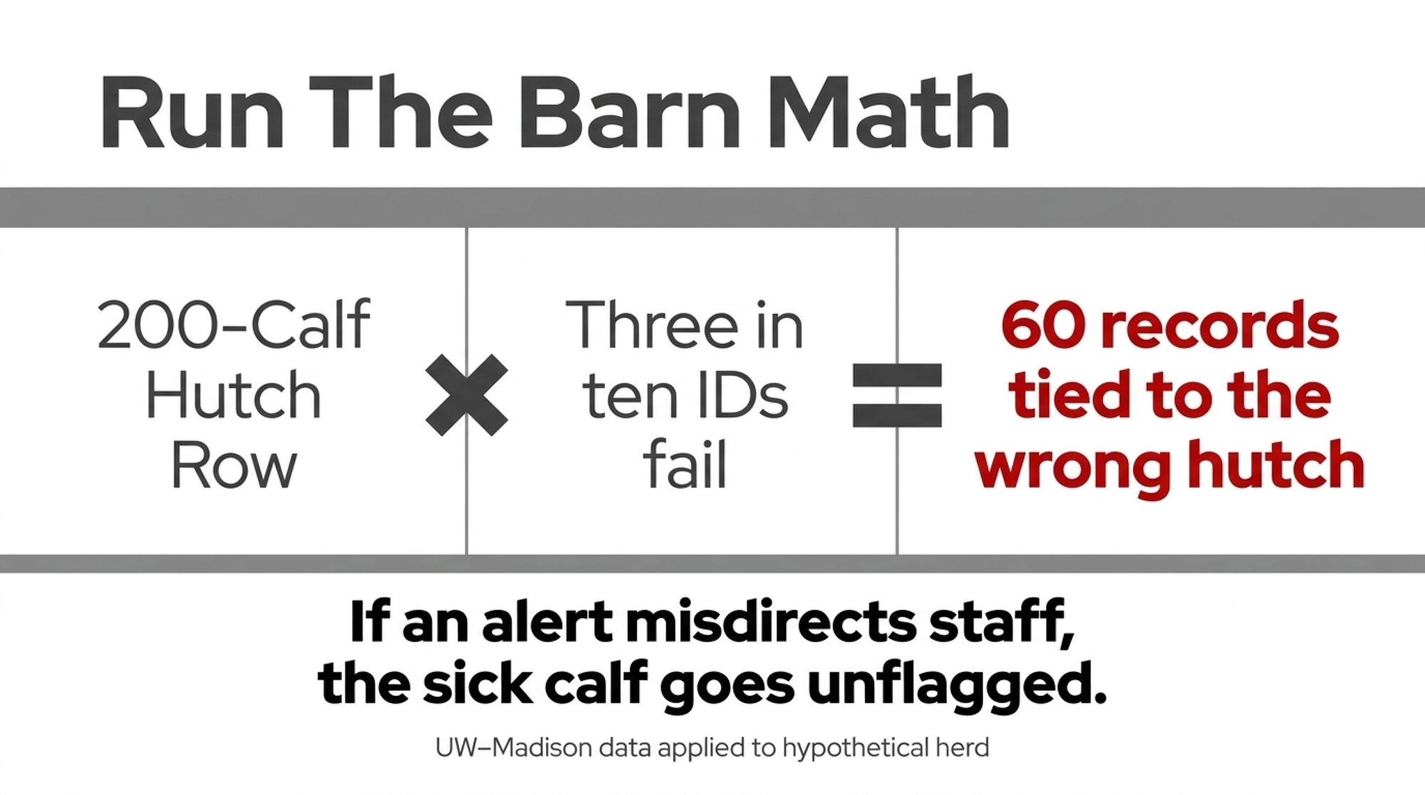
Run the barn math. At 70 percent, roughly three in ten identifications point at the wrong animal. Apply that rate to a 200-calf setup and about 60 calves at any given check would have their data tied to the wrong hutch (Bullvine illustration: the UW–Madison error rate applied to a hypothetical herd). If that output is a health alert, a staff member walks to the wrong pen and the sick calf goes unflagged.
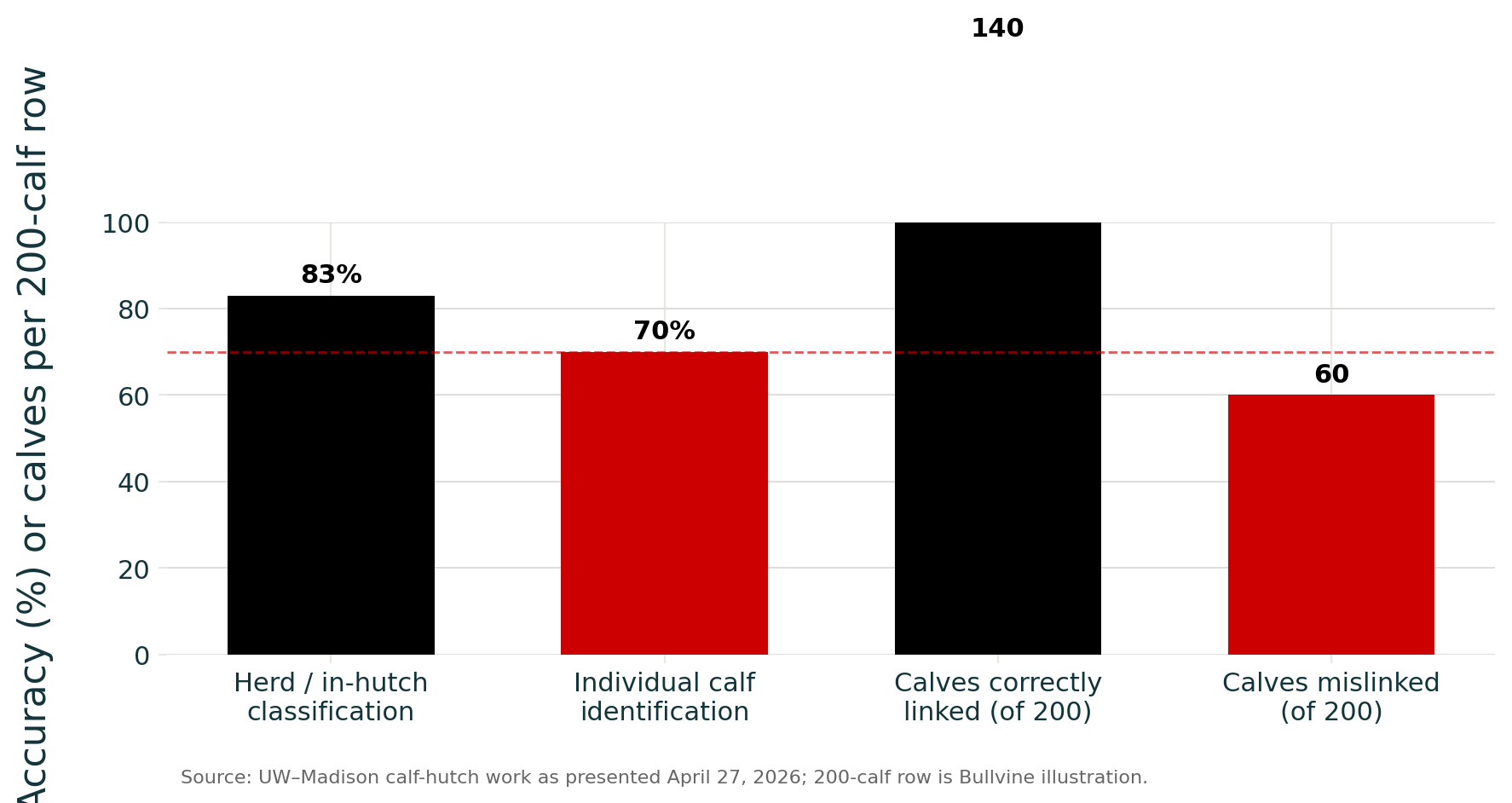
Mazon described tracking individual calves and tying that drone data to regular farm records on health and performance as the next step. This study didn’t measure whether the system catches a sick calf. The 70 percent tells you it struggles to know who it’s watching. It tells you nothing about whether it can spot that the calf is sick.
| Claim a vendor may make | Evidence in this article | Bullvine read |
| “The drone can tell whether calves are in their hutches.” | UW–Madison herd / in-hutch classification: 83% | Useful as a broad location signal, not a health verdict |
| “The drone knows which calf it is seeing.” | Individual calf identification: ~70% | Roughly 3 in 10 IDs can point to the wrong calf |
| “The drone catches sick calves.” | No published sick-calf detection result reported | Wait: the study did not test this claim |
| “The system creates a real-time health alert.” | Images were processed after flights | Not a live alert system in the UW–Madison work |
| “Drone monitoring replaces animal sensors.” | NTC uses collars, rumen boluses, robot yield data and body weights | Drones fit field scouting better than individual cow health monitoring |
Edward Barraclough, who founded the Australian livestock-drone company Drone-Hand, puts the line in the same place.
“We can’t say the animal has a fever or anything like that. It’s more what are the visual and behavioral indicators that would say this animal’s in trouble.”
— Edward Barraclough, founder, Drone-Hand, to AgFunderNews, February 3, 2026
One more limit the sales deck skips: all of the UW–Madison work needed image processing after the flight. None of it ran as a live alert. Dr. Victor Cabrera was listed on the webinar program but was traveling and didn’t present, which is worth knowing because a name on a program reads like an endorsement.
Below, we price year one in both US and Canadian dollars and rerun the spray-drone payback at 500, 1,000 and 2,000 acres, using University of Missouri Extension figures and our own reporting.
Lessons from NTC: Drones for the Fields, Sensors for the Cows
North of Wausau, there’s a working farm that splits the jobs the same way.
Northcentral Technical College’s Agriculture Center of Excellence sits on County Road K in the Village of Maine. NTC describes it as the only working dairy farm and learning laboratory in the Wisconsin Technical College System. The Daily Cardinal reported in November 2025 that the 120-acre farm has about 55 dairy cattle, all milked robotically. NTC says the average cow is milked three times a day and gives roughly 90 pounds of milk. Students can take Drone Remote Pilot In-Command, which prepares them for the FAA Part 107 exam, and then Agriculture Drone Applications.
The Daily Cardinal reported that the farm flies its drones for field work: mapping fields, finding weeds, and pinpointing where fertilizer is needed. “Drones go around and read where weeds are and only turn the sprayer on when it finds a weed, until then it keeps it off,” said Dr. Greg Cisewski, dean of NTC’s School of Agricultural Sciences, Utilities and Transportation.
The cows are watched another way. Collars track movement, and a rumen bolus reads body temperature closely enough to catch minute changes. “We can see a small change and we know she’s going to have her calf in six hours,” Cisewski told the paper. Cud chewing, per-quarter yield, and body weight all reach farm staff through the robots.
NTC hasn’t framed that split as a strategy, and we won’t put words in their mouth. But it matches what the published research supports. NTC’s calves go into individual pens and hutches, bottle-fed by hand at first, then moved onto an automatic feeder until weaning at about three months. That’s the same housing UW–Madison flew its drone over, and the same setting where the accuracy runs out.
The Science: What Flying Sensors Can and Cannot Measure
Before you look at animal monitoring, look at what drones measure well right now: gases coming off a pasture, and how much ground cover it carries. Both have peer-reviewed numbers behind them. Neither requires knowing which animal you’re looking at.
Akdeniz’s team built what she calls a flying air analyzer. An 800-gram Scentroid DR2000 sensor package hangs under a small drone on an 88-centimeter probe held out upwind, so the propeller wash never reaches the air intake. It flew at one meter in ten-minute runs, collecting roughly 70 readings per measurement per flight. A conventional ground chamber gets a handful over the same area.
Two open-access papers came out of it:
- Methods: Yang, Wang and Akdeniz, Remote Sensing 2024, 16(16), article 3007. It showed that the 88 cm probe keeps propeller wash out of the readings on rotationally grazed dairy pasture in northern Wisconsin.
- Results: Yang, Akdeniz and Karthikeyan, Remote Sensing 2025, 17(17), article 3059.
Checked against lab gas analysis, the drone’s readings closely tracked the lab’s. The statistical fit was an R² of 0.86, meaning the drone explained 86 percent of the variation between samples. On average, it read 9.7 ppm high across a 450-to-650 ppm range, with an error of about 1.5 to 2 percent. That’s an instrument you can take to a field.
The team sampled five rotationally grazed sites, five visits each between June and October: two beef pastures, two dairy, and a sheep site at the Arlington Sheep Research Unit. All were cool-season grass with under 30 percent legume. Animals were moved twice a week on 28-to-30-day rests. Paddocks ranged from about half an acre to just over an acre.
The conventional dairy site put out most of the gases measured, and the sheep site the least methane. But the finding that matters for management had nothing to do with species. Rain of 5 mm or more within five days of sampling pushed nitrous oxide emissions up more than fourfold. Dust and particle emissions tracked how much forage was standing, and peaked on the barest paddocks.
Run that back through your own rotation. Nitrogen the forage doesn’t take up has to go somewhere, and this study measured where. A paddock your grazier keeps calling “a bit thin” is yielding less and losing applied N to the air as well. That points at your rest interval and stocking density before it points at your fertilizer bill.
Counting Cattle Is the One Animal Job Drones Have Proven
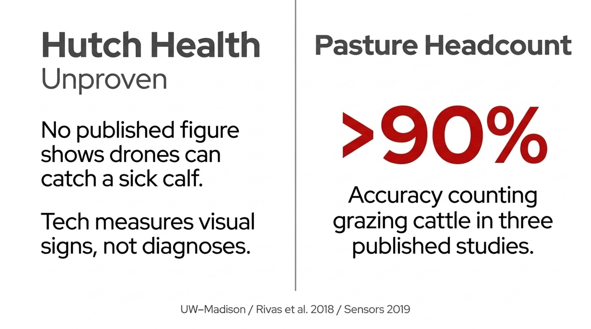
Three published studies each report counting accuracy above 90 percent, though they measure it slightly differently:
- Rivas et al., Sensors 2018: 95.5 percent detection accuracy
- Sensors 2019: 15 image-recognition models tested on 8,629 cattle images, most above 95 percent
- Asian Journal of Dairy and Food Research 2025: 92.5 percent on a combined score of animals found and false counts avoided
Two caveats before you apply that to your place. None of this work was done on dairy cattle in hutches or freestalls. It’s pasture and rangeland research, which is where the accuracy holds. And the studies don’t consistently report how high they flew, so it isn’t clear the results carry over to the 60 feet UW–Madison flew over calf hutches. Higher flights mean blurrier animals, and blurrier animals mean lower accuracy.
Guilherme Menezes, of Joao Dorea’s Digital Livestock Lab at UW–Madison, has worked on both pastures and cattle. As presented at the webinar, his camera work across 11 Wisconsin farms predicted pasture fiber, protein and energy well, and total forage mass at about 70 percent. Presenting his follow-up work with grazing cattle, Mazon reported 97 percent accuracy counting cows and close to 90 percent on body weight in grazing heifers. The body-weight study has been published only as a meeting abstract (October 2025), and we couldn’t find the counting result in print. Treat both as promising until a full paper is out.
The Hardware Confusion: Scouting vs. Multispectral vs. Spray
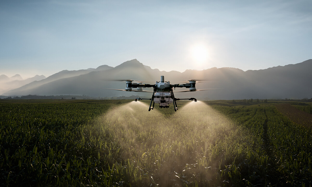
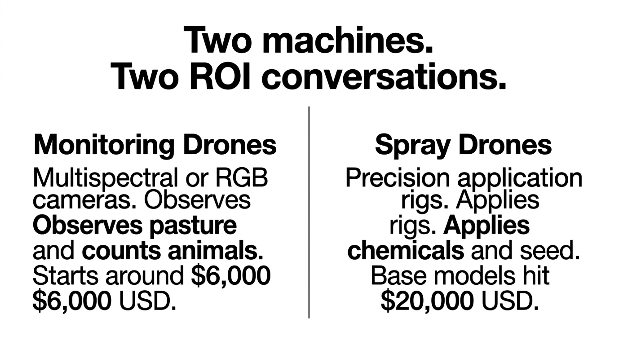
“Drones for dairy” covers three price classes that have almost nothing to do with each other.
| Scouting | Multispectral: DJI Mavic 3 Multispectral (Mavic 3M) | Spray | |
| Initial investment | ~US$1,500 | US$5,699–5,919 (US, 2026); CA$5,945–6,930 (Canada, Sept 2026) | US$25,000–56,000 depending on what’s included |
| What it does | Visual field checks, headcount, early problem detection | Sees beyond visible light: pasture quality, fertility mapping | Applies chemicals |
| Training time | 25–30 hours (US Part 107 study) | 25–30 hours (US Part 107 study) | 100+ hours |
| Annual operating cost | US$300–500 | About US$1,790–2,910 (insurance + mapping software) | US$3,000–8,000; batteries alone run US$3,000–4,000 |
| Payback | 6–12 months | Depends on your agronomist’s per-acre rate | About 7–15 years at 1,000 acres; about 1.6–3.6 years at 2,000 acres, depending on setup cost |
Pilot certificates: in the US, Part 107 for all three, plus state licenses for spray. In Canada, a Basic or Advanced certificate for scouting and multispectral, and an Advanced certificate for most spray rigs (25–150 kg), plus provincial licensing.
The spray range is wide for a reason. Our May 2026 reporting found a DJI Agras T40 ready-to-fly kit listed at roughly CA$36,999 at DrDrone.ca, and base aircraft at US$20,000–28,000 at US dealers. A fully equipped setup (batteries, charger, precision GPS) ran closer to US$25,000–28,000. Our September 2025 reporting put a complete spray setup near US$56,000 once support equipment and training were counted. Both figures are real; they just cover different things. Make any quote spell out exactly what’s in the box.
Our scouting-versus-spray breakdown put a scouting drone at about US$1,500 with a 6-to-12-month payback. That’s why the entry tier makes sense for nearly any operation, and why the jump to five figures usually doesn’t.
Settle which tier you need before a rep walks you up the ladder. If a US$1,500 scouting drone solves the problem you actually have, you never need the multispectral conversation.
The US Rules After the FCC’s December 22 Listing
Two federal actions took effect on December 22, 2025. Under the American Security Drone Act, federal agencies can’t buy or operate drones from covered foreign manufacturers, and federal grant money can’t be used to buy or operate them. That’s why Akdeniz told the webinar she’s replacing the drone used in her study. The same day, the Federal Communications Commission added all foreign-made drones and their critical components to its Covered List, and named all communications and video-surveillance equipment from DJI and Autel specifically, according to Iowa State University’s Center for Agricultural Law and Taxation (August 10, 2026).
The rule doesn’t ground you. Models the FCC approved before the listing can still be sold and flown, though the FCC set aside some approvals granted in the 30 days before it. New foreign-made models, including DJI’s 2026 releases, can’t get FCC equipment approval, and a January 2026 exemption for some foreign manufacturers runs only to January 1, 2027 and covers no DJI or Autel product. Software updates are the sleeper issue. The listing reaches them too, and the FCC has waived that for previously approved equipment only through January 1, 2029.
For a producer, the real risk is resale value and support. If your payback assumes selling the drone in year five, it’s unclear who will buy it or whether parts and updates will be available, so budget as though resale is thin.
What Canada’s SPN2026-02 Allows, and What It Doesn’t
Canada changed on June 30, 2026. That day, Health Canada finalized Science Policy Note SPN2026-02. It allows drone application of any pesticide already registered for conventional aerial application, with no label change required. It covers farmers spraying their own land as well as commercial applicators. The policy followed a public consultation that opened on February 23, 2026.
If you read anything before July saying Canadian producers were effectively locked out of drone spraying, including our own September 2025 reporting, that’s no longer true.
The label still rules. If it says “DO NOT apply by air,” or has no aerial directions at all, drone application is prohibited, and the company that registered a product can opt it out of drone use. If aerial application is on the label, every aerial direction still applies, including rate, number of applications, time between applications, minimum spray volume, and droplet size. Drones must use the buffer zones set for helicopters, a deliberately cautious choice until drone-specific drift models are ready. The one rule that doesn’t carry over is the limit on boom width of 65 percent of wing or rotor span.
Then there’s the crew. The person who mixes the product can’t be the pilot, so plan on two people for every spray job. The pilot and anyone handling the drone wear the protective equipment the label sets for ground spraying. If the label requires a closed cab for ground application, the product can’t go on by drone unless the pilot has equivalent closed-cab protection designed for drones.
Your certificate has to match the drone’s weight. Transport Canada treats any flight with a medium drone, over 25 kg up to 150 kg, as an Advanced operation when flown within sight, which means an online exam and an in-person flight review. Lower-risk flights beyond sight need a Level 1 Complex certificate, and anything over 150 kg needs a special flight permit.
Provincial rules sit on top, and they vary. Farmers spraying their own crops are exempt from applicator licensing in Manitoba and Saskatchewan, according to Manitoba Crop Alliance and The Grower. Ontario is the exception that matters most here. The Grower Pesticide Safety Course doesn’t cover aerial work, so an Ontario farmer who wants to drone-spray even their own crops needs a provincial exterminator license with the aerial category, The Grower reported on July 25, 2026.
Monitoring Drones in Canada: About CA$20 in Transport Canada Fees
For monitoring drones, Canada’s entry cost stays low. Transport Canada requires every drone weighing 250 grams or more to be registered and marked with its registration number, at CA$10 per aircraft. Basic Operations means open airspace, staying at least 30 meters from bystanders and never flying over them. It requires a Basic pilot certificate from an online exam: CA$10, 35 multiple-choice questions, 90 minutes, 65 percent to pass. The certificate doesn’t expire, though you have to keep your skills up to date to keep flying. Flying without meeting those requirements can bring a fine of CA$5,000 for recreational users or CA$25,000 for commercial users.
Mapping your own fields, away from people, in open airspace is a textbook Basic operation. That’s CA$20 in fees, plus study time and an optional prep course.
Insurance is where the two countries’ practice differs most on paper. Canadian aviation rules don’t require liability coverage for Basic or Advanced operations with small drones; Transport Canada recommends it but doesn’t compel it. The FAA doesn’t require it in the US either, though clients and contracts often do.
The Barn Math: Year-One Investment Breakdown
| Cost item | United States | Canada |
| Aircraft¹ | US$5,699–5,919 | CA$5,945–6,930 |
| Certification² | US$175 FAA knowledge test + US$5 FAA registration; prep courses extra | CA$10 registration + CA$10 Basic exam; prep courses ~CA$95 |
| Liability insurance³ | ~US$500–1,000/yr for US$1M liability-only cover | Not required |
| Mapping software⁴ | US$1,290–1,908/yr | Same platforms; confirm billing currency |
| Year 1 total | ~US$7,670–9,010, plus any prep course | CA$5,965–6,950, plus software |
¹ US: enterprise dealer listings, 2026 (UAV Coach; US Ag Drone Directory, a dealer-price aggregator). Canada: Drone Spray Canada, DrDrone, DroneXperts and DronePoint listings, September 2026, up to DronePoint’s Plus Combo. ² The US test fee is paid to PSI. US study time is 25–30 hours for Part 107, per Wisconsin Farm Bureau’s training program. Canadian certificates don’t expire, though skills must be kept up to date. The Canadian total excludes the optional ~CA$95 prep course. ³ Guide estimate for liability-only cover (The Drone U, May 2026). It isn’t an FAA requirement either, but contracts often require it. ⁴ PIX4Dcloud Starter and DroneDeploy Ag Lite, published pricing checked September 25, 2026.
Three things that table won’t tell you:
- Configuration and currency explain most quote gaps. The same DJI Mavic 3 Multispectral (Mavic 3M) was listed at US$5,729 at UAV Coach in April 2026 and at CA$5,945–6,930 at Canadian dealers in September 2026, from base kit up to DronePoint’s Plus Combo. Make every quote state what’s in the box and which dollar it’s in.
- The number that decides your payback is one no vendor has: your agronomist’s per-acre rate for multispectral scouting. Get it, multiply by your acres, and divide it into the year-one total.
- Set a return threshold before you shop. Gary Sipiorski, a dairy financial consultant working with producers across the Midwest, compares it with leaving the money in the bank: with CD rates running 4 to 5 percent, a technology investment should target at least 15 percent ROI to justify the added risk and management load. That same Bullvine article suggests a second rule: plan on getting 50 to 60 percent of the benefits a vendor advertises, which is roughly where farm results land against trade-show claims.
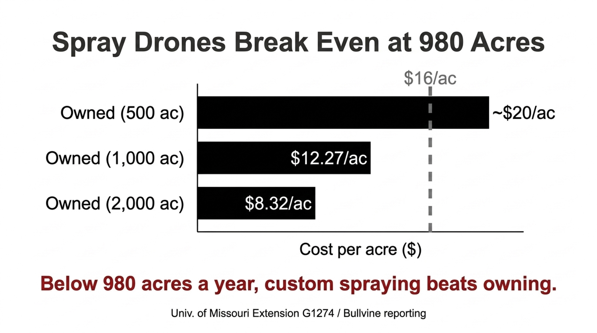
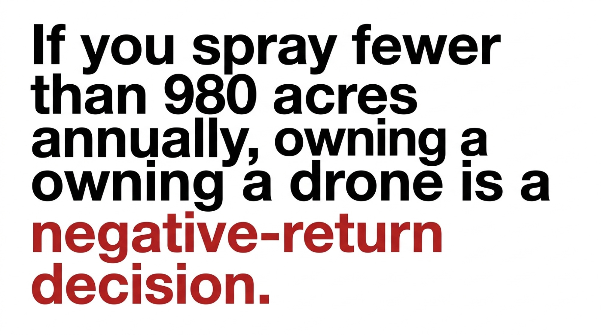
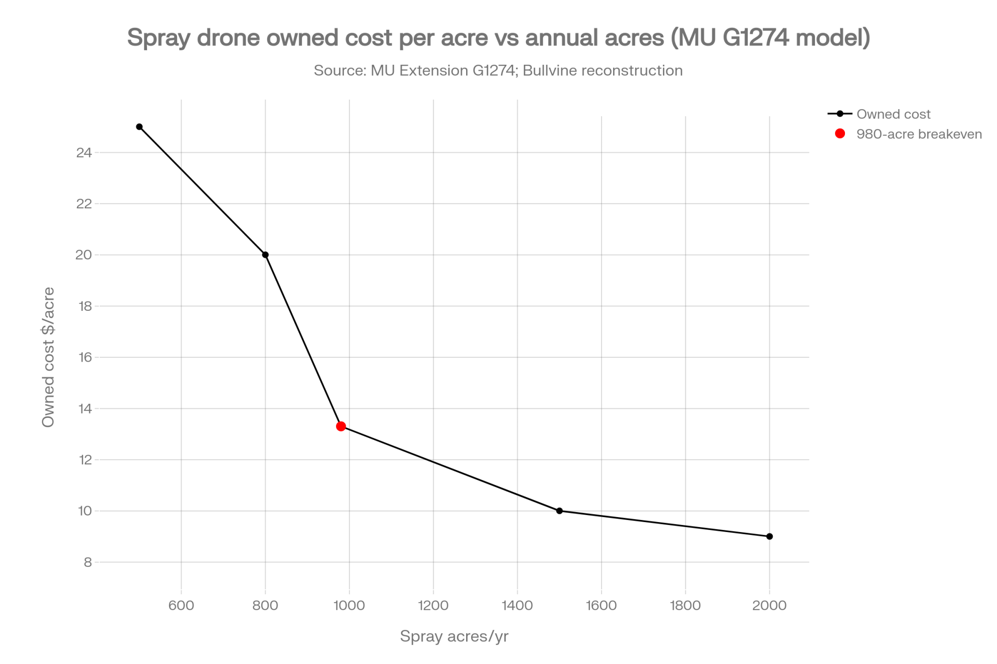
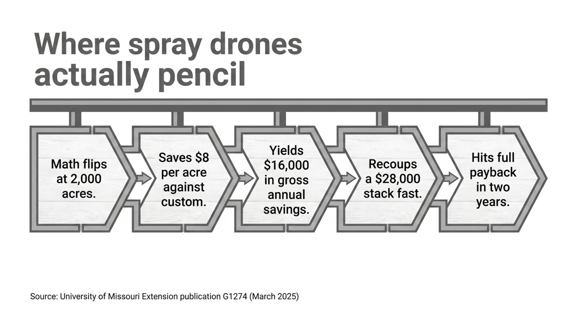
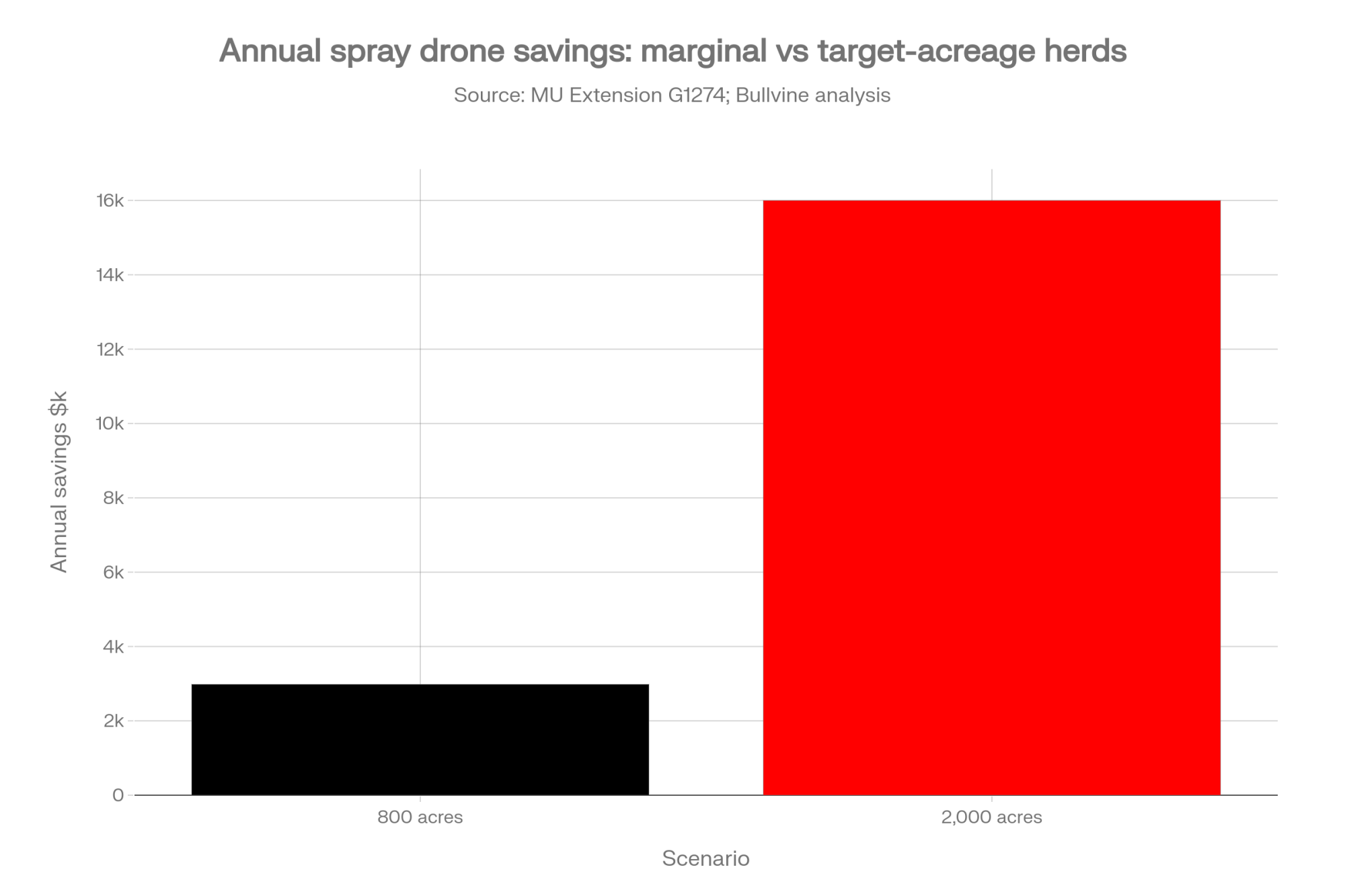
If a rep quotes you spray-drone acreage math, know what it describes. University of Missouri Extension publication G1274 (March 2025), modeled on an Agras T40, puts a farmer’s owned cost at US$12.27 an acre at 1,000 acres and US$8.32 at 2,000, against a typical US$16 custom rate. Ownership breaks even at 980 acres a year. Our September 2025 reporting found Midwest custom rates had already fallen from US$22–25 per acre in 2023 to US$15–18, which makes owning look worse, not better. At 500 acres, owning ran about US$20 an acre against US$17 custom in that reporting, so it never pays back.
At 1,000 acres, G1274’s numbers save about US$3,730 a year against custom work. That’s a payback of about 7 to 7.5 years on a US$25,000–28,000 setup, or 15 years on the US$56,000 complete setup. At 2,000 acres, it flips: US$8.32 owned against US$16 custom saves about US$15,360 a year, paying back a US$25,000–28,000 setup in about 1.6 to 1.8 years, or the US$56,000 setup in about 3.6 years (Bullvine calculation on G1274 inputs). In Canada, add the second crew member the new rules require to your labor line before you run the numbers. We walked through the full acreage curve in May; this piece is the peer-reviewed follow-up.
Are You the Missing Voice?
Here’s what this article can’t tell you. Every number above comes from researchers, dealers, extension publications, or regulators. None comes from a commercial dairy operator who spent their own money on a drone and lived with the result. In researching this piece, we found no commercial dairy operator in Wisconsin, the upper Midwest, or Ontario who has published drone ROI figures in trade media or peer-reviewed work.
If you’re running a Mavic 3M or an Agras, we want your numbers for the follow-up: what you paid, what you flew, what broke, what you’d buy again. Skip the marketing gloss and send the hours and the acres.
Email editorial@thebullvine.com with the subject line “Drone ROI — Your State or Province.” Submissions are confidential by default. We’ll use your name only with your written consent, and we don’t share contact information with third parties.
The Strategic Matrix
These verdicts are The Bullvine’s reading of the published evidence, not positions taken by the researchers cited.
| Use | Evidence | Verdict | Where it backfires |
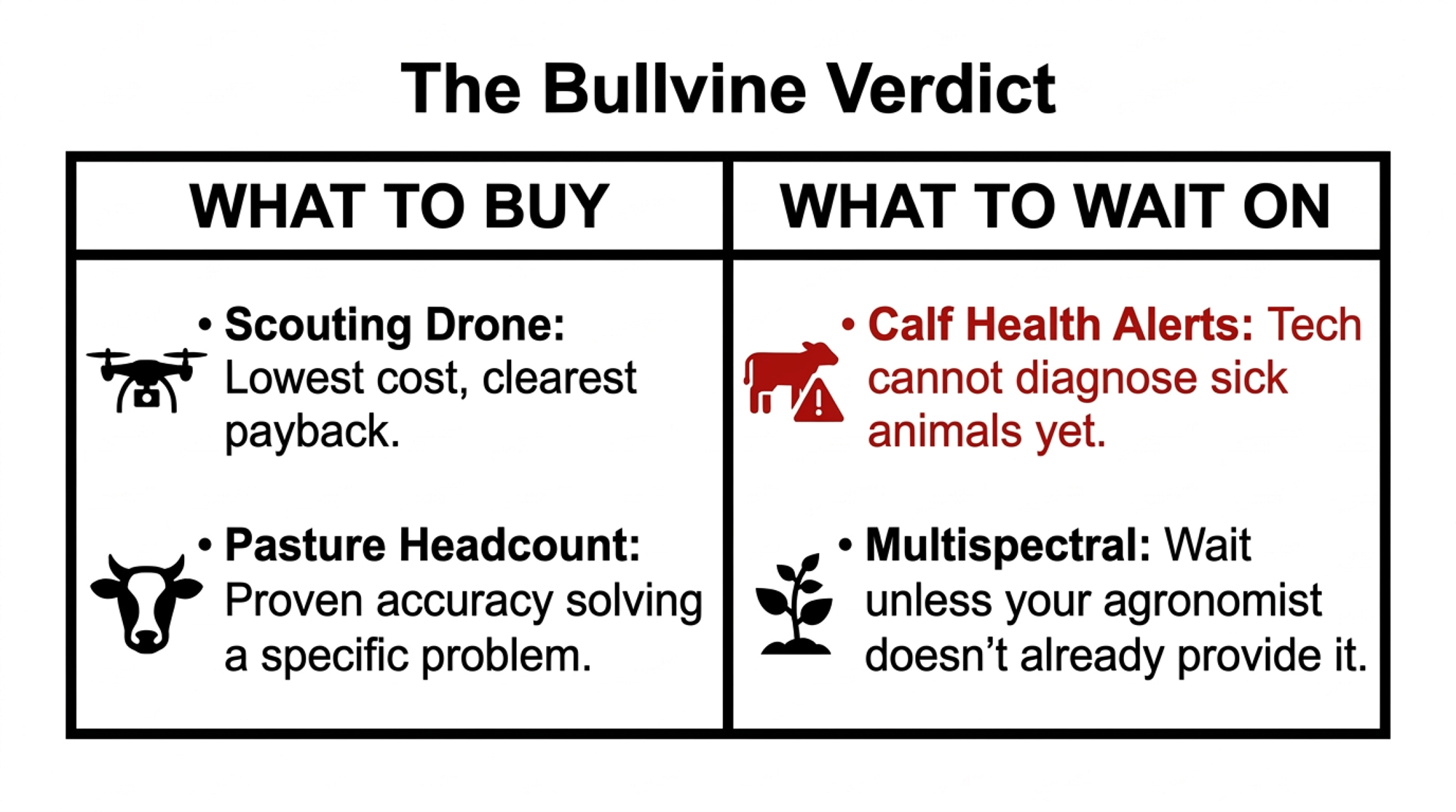
| Headcount on scattered ground | Above 90% in three published studies since 2018, on pasture | Buy, if you have a real counting problem | You don’t have one. Proven tech solving a problem you don’t have is still a bad buy |
| Weed and crop scouting | NTC’s working setup; ~US$1,500 entry; 6–12 month payback in our 2025 reporting | Buy: lowest cost, clearest payback | Your agronomist already covers it in your contract |
| Pasture quality | Fiber, protein, energy predicted well across 11 farms; forage mass ~70% | Pilot: good for trends, not precise readings | It starts replacing forage testing in ration work |
| Calf health / individual ID | 70% identification; no published figure for catching sick calves | Wait | It’s used as a health-alert system before its ability to catch sick calves has been measured |
What This Means for Your Operation: A 5-Point Vendor Checklist
- “Does your accuracy number mean spotting an animal, or identifying which one?” The published research keeps those separate, and most pitches don’t. If the rep can’t answer, the number is decoration. Robot dealers have the same habit with the metric that predicts payback.
- “Show me what’s included and what currency this quote is in.” Then compare it with a second quote written the same way. In the US, also ask what happens to software updates after January 1, 2029.
- “Which peer-reviewed study backs your health-detection claim?” Drone-Hand’s own founder describes what drones see as visual and behavioral warning signs, not diagnoses. Anyone claiming more should be able to point you to a study.
- This month, before any dealer meeting, call your agronomist. Ask whether multispectral scouting is already in your service contract. If it is, buying a drone adds a capital cost without cutting an operating cost. That one call settles the question for a lot of operations.
- Canadian growers: check the label and your province before you price a spray drone. Search Health Canada’s Pesticide Label Database for the products you actually use; if aerial application isn’t on the label, drone application isn’t legal. Then check your provincial license, since Ontario requires an exterminator license with the aerial category even on your own crops. Last, ask your broker about a drone rider, since neither country’s aviation rules make you carry coverage.
The example Cisewski gave wasn’t from the air. It was a rumen bolus catching a temperature change small enough to flag a calving six hours out, a signal no drone can pick up. The question in front of you isn’t whether drones work; it’s which job you’re giving them. So what does your next vendor conversation open with: the accuracy number, or which accuracy number it is?
Key Takeaways
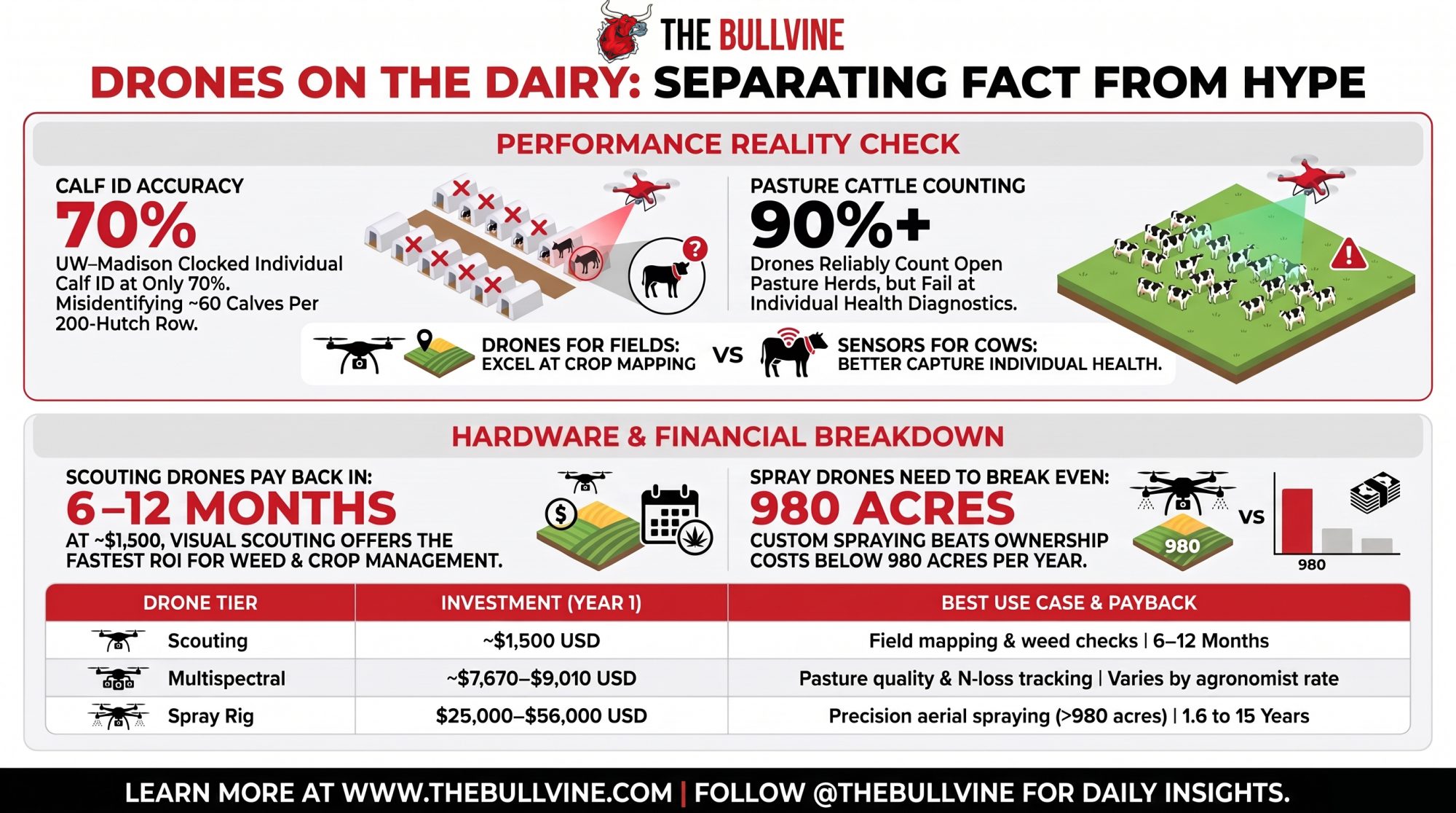
- Treat drone calf-health alerts as unproven: the UW–Madison study measured who the drone was watching, not whether it caught a sick calf.
- On pasture, drones count cattle at better than 90 percent in three published studies. That’s the animal job to buy for; hutch-by-hutch calf monitoring isn’t there yet.
- Below 980 acres a year, custom spraying beats owning on University of Missouri Extension’s numbers. At 2,000 acres, a US$25,000–28,000 rig pays back in under two years on our math.
- Plan on about US$7,670–9,010, or CA$5,965–6,950 plus software, for a Mavic 3M’s first year, and budget as if resale is thin now that new foreign models can’t get FCC approval.
Complete references and supporting documentation are available upon request by contacting the editorial team at editor@thebullvine.com.
Learn More
- The $7,200 Lameness Fix That Beats $45,000 Technology (40-50% Reduction Proven) — Delivers an immediate protocol audit for your hoof health budget, proving disciplined footbath routines slash lameness by 40–50% within six months while cutting equipment capital by 86%.
- Dairy Tech ROI: The Questions That Separate $50K Wins from $200K Mistakes — Arms you with a strict capital filter across herd sizes, exposing why automation projects fail below 180 cows and how to demand a 15% hurdle rate.
- Computer Vision: Your New Front-Line Defender — Contrasts unproven aerial monitoring with stationary parlor-exit camera algorithms, revealing how automated gait analytics reclaim $13–$99 per cow annually by catching subclinical disease days before visual checks.
 The Sunday Read Dairy Professionals Don’t Skip.
 The Sunday Read Dairy Professionals Don’t Skip.
Every week, thousands of producers, breeders, and industry insiders open Bullvine Weekly for genetics insights, market shifts, and profit strategies they won’t find anywhere else. One email. Five minutes. Smarter decisions all week.